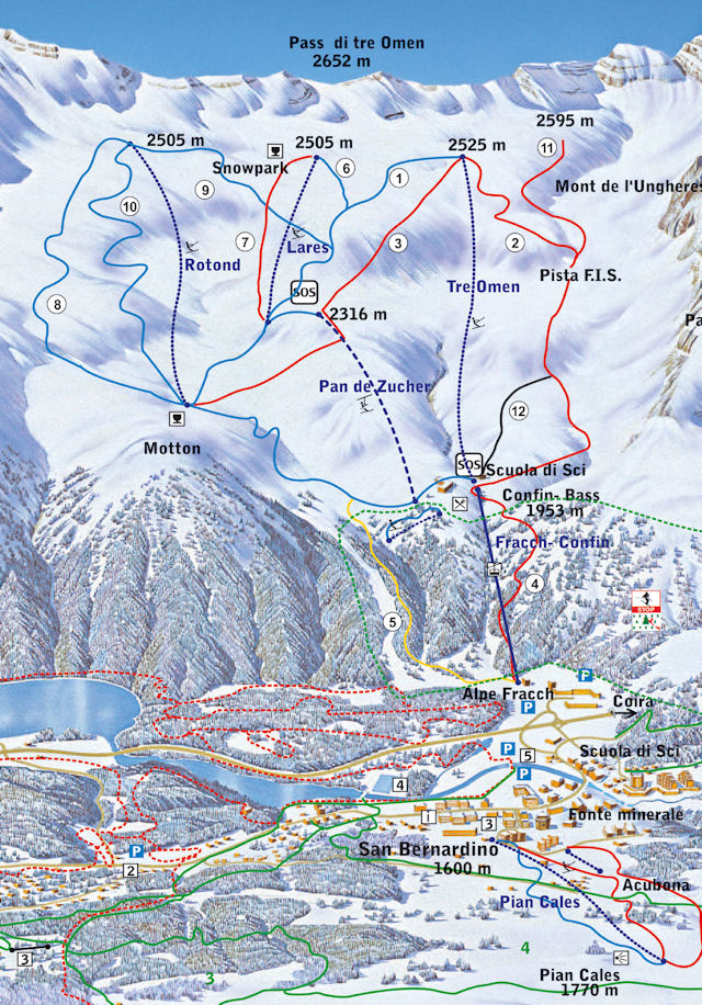
One of the few Italian-speaking communities in Graubünden/Grisons, the village lies at the southern entrance to the San Bernardino road tunnel on the A13 highway that runs from Ascona to Lake Constance. There are a couple of ski lifts in the village itself (Pian Cales), but the main ski area is above the village, accessed by the Alpe Fracch gondola.
Getting There
By Public Transport
The best destination to access the downhill slopes by public transport in this ski area is San Bernardino, Impianti Confin . The bus stop is adjacent to valley station. You need to reserve a seat on the bus at Bellinzona, which is very straightforward.
- From Basel the least travel time is 4 hrs 44 mins with as few as 1 changes going via Bellinzona.
- From Lugano the least travel time is 1 hr 47 mins with as few as 1 changes going via Bellinzona.
By Road
Please refer to a map and check local conditions for accurate routing information.
As the crow flies, the resort is respectively 176km, 122km and 239km from Basel, Zurich and Geneva airports, 145km, 96km and 197km from Berne, Lucerne and Lausanne, and 875km from London.
Nearby Resorts
Other nearby Italian-speaking resorts include Airolo, Nara and Cari.
Weather Outlook

View detailed snow forecast for San Bernardino at:
snow-forecast.com
Latest Snow Report
Snow Report for resort provided by Snow-Forecast.com
Piste Map

Map
Get directions from Google in a new window or tab
Accommodation in the Resort and Surrounding Area
See Where to Stay for more details on accommodation options.
Find accommodation at Bookings.com
