L
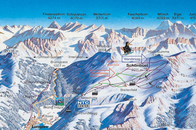
ungern-Schönbüel is on the Brünig Pass halfway between Lucerne and Interlaken. There is a modest winter sports area above Lungern with fabulous views from the top of Schönbüel towards the Brienzer Rothorn and the Jungfrau range. There is a toboggan run, some excellent winter and snowshoe walks and the opportunity to hire some whacky winter sports equipment with a Snow Fun Card. A cable car from Lungern runs up to the pistes, all of which are above 1550m, serviced by a chairlift and two surface lifts. I'm not sure if it is possible to ski all the way down to Lungern but haven't seen any obvious routes to do so - certainly there are no marked trails or pistes. The station is on the very scenic Brunig line that runs from Lucerne to Interlaken, and is close to the winter sports resorts of Meiringen and Giswil-Morlialp on the same line.
Getting There
By Public Transport
The best destination to access the downhill slopes by public transport in this ski area is Lungern. There is a courtesy shuttle bus from the station to the lifts - it is a bit of a hike to walk.
- From Basel the least travel time is 2 hrs 26 mins with as few as 1 changes going via Luzern.
By Road
Please refer to a map and check local conditions for accurate routing information.
- The road distance from Zurich is around 87 km and the journey time is roughly 1 hr.
- The road distance from Basel is around 131 km and the journey time is roughly 1 hr 30 mins.
Get road directions at Google Maps
Weather Outlook
 View detailed snow forecast for Lungern/Schoenbueel at: |
Piste Map for Lungern

Map
Get directions from Google in a new window or tab
Lungern is located in Obwalden
 Winter Sports in Lungern